* Aviation Tools
 *** Free Version ***
If you want to make a donation and/or get rid of the ads, search for "Aviation Tools Donate" in the market.
Aviation Tools is a pilot tool for preparing flights.
Get instant access to useful informations : METARs, TAFs, NOTAMs, AFD ...
Available languages: English, French, German, Italian, Norwegian, Spanish
Danish, Portuguese
If you want to translate/correct :
http://www.getlocalization.com/aviatools/
Available Maps: USA, France, Italy (VATSIM), Netherlands, Norway, UK, Spain, South Africa
Contact to add more maps (I need a free website with PDF).
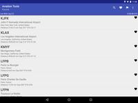
- Quickly find the nearest airports (displaying the distance and bearing)
- Weather information and NOTAMs (remain available offline),
- Download directly all available documentations (AFD, TAKE-OFF MINIMUMS, ILS...)
- Call ATIS directly from the application,
- Calculate sunset and sunrise,
- Inline airport Editor to add or change an airport (collaborative)
- Worldwide database pre-loaded
- If you are not French use FAA source for NOTAMs (Note: go to menu Preferences and select "FAA")
- The METARs TAFs and are decoded and converted according to selected units in the "Preferences"
- And much more...
Feel free to contact me if you have problems or if you have ideas for new features or if you need a better support for your country.
Author: Alexandre Del Bigio
Version: 2.3.7
Market link: org.cosinus.aviatool
Web site: https://plus.google.com/u/0/116118235128551481895/posts

Source code:
Code license:
Market downloads: 50,000-250,000
Market rating: 4.4 / 5.0
Category: Top:/Applications/Tools
Added: 2011-02-28
Updated: 2017-02-21
Hits: 1375